Multimedia |
Messengers |
Desktop |
Development |
Education |
Games |
Graphics |
Networking |
Security |
Servers |
Utilities |
Web Dev
GeoImaging Tools
By PCI Geomatics
Rating:
 0/5 (0)
0/5 (0)
License type:
Demo
Home page:
www.pcigeomatics.com
Latest version:
2.0
Last updated:
May 27th, 2020
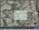
GeoImaging Tools for ArcGIS provides ArcGIS users a suite of tools for processing and analyzing imagery in the GIS.
PCI Geomatics is introducing a suite of modules that integrate directly into...
PCI Geomatics is introducing a suite of modules that integrate directly into...