Multimedia |
Messengers |
Desktop |
Development |
Education |
Games |
Graphics |
Networking |
Security |
Servers |
Utilities |
Web Dev
Trimble Aerial Imaging
By Trimble Navigation Ltd
Rating:
 0/5 (0)
 0/5 (0)
License type:
Demo
Home page:
www.trimble.com
Latest version:
1.1.4.3
Last updated:
June 6th, 2016
This review applies to version 1.1.
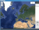
Trimble Aerial Imaging is a program designed for planning your aerial missions, performing pre-flight checks and monitoring your flights. The operator is guided through the pre- and post-flight...

