Multimedia |
Messengers |
Desktop |
Development |
Education |
Games |
Graphics |
Networking |
Security |
Servers |
Utilities |
Web Dev
Home ›
ESRI Nautical Solution
ESRI Nautical Solution
By Environmental Systems Research Institute, Inc.
Rating:
 5/5 (2)
 5/5 (2)
License type:
Demo
Home page:
www.esri.com
Latest version:
10.0
Last updated:
December 7th, 2011
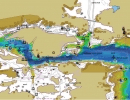
Esri Nautical Solution (formerly PLTS for ArcGIS—Nautical Solution) helps national hydrographic offices, charting agencies, and subcontractors solve the challenges of managing large volumes of data...


