Multimedia |
Messengers |
Desktop |
Development |
Education |
Games |
Graphics |
Networking |
Security |
Servers |
Utilities |
Web Dev
DSAS
By U.S. Geological Survey
Rating:
 3/5 (1)
3/5 (1)
License type:
Freeware
Latest version:
4.3
Last updated:
March 21st, 2013
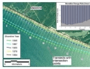
The Digital Shoreline Analysis System (DSAS) is an application that enables a user to calculate shoreline rate-of-change statistics from multiple historic shoreline positions. DSAS computes shoreline...