Multimedia |
Messengers |
Desktop |
Development |
Education |
Games |
Graphics |
Networking |
Security |
Servers |
Utilities |
Web Dev
Home ›
Development ›
Geographical Simulation and Optimization Systems
Geographical Simulation and Optimization Systems
By Prof. Xia Li

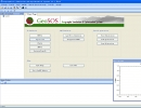
A Geographical Simulation and Optimization System (GeoSOS) is a computer-based system capable of simulating, predicting, optimizing, and displaying geographical patterns and processes. GeoSOS has...
Download:
https://www.geosimulation.cn/GeoSOS/GeoSOS%201.2.1%20Setup.rar
11.87 MB Downloaded 9 times
11.87 MB Downloaded 9 times